November, 2000
I waved goodbye to my roommate as I entered the current of the Hatchie. He had some misgivings about the whole adventure, especially the part about getting into the Mississippi. But it was a beautiful day and I was ready for an adventure. The level of the river was quite low, but there was still a significant current to help carry me along.

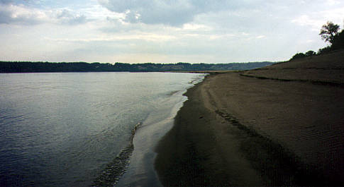
Sandy beaches around every turn, and yet storm clouds threatened...

Picture perfect... smooth running...

Until a low water logjam caused me to have to get out and pull the boat!

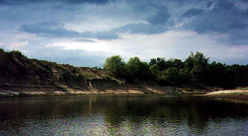
Back in the clear. Previous high water levels are evident in this bank erosion...
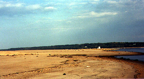
The last mile of the Hatchie River spreads out quite a bit and there is no discernable
current, so you have to paddle for the towhead, seen below on the right side of the
picture. It had gotten quite dark from a storm cloud and since I was tired, I stopped
at the tip of the towhead and walked around a bit to stretch and eat a sandwich
before launching into the Big Muddy.

I was expecting a fast moving and turbulent river, but what I saw was as smooth as
glass. My heart was pounding, but I didn't know why. I felt very small and that I
was entering something very big. As I eased out into the smooth water, it seemed
to be breathing, rising and falling with a motion that I could plainly feel, yet I
could not really see any motion on the surface of the water.

There was no barge traffic in sight, and I knew I needed to cross immediately to
carry out my plan of "keep to the sandy side." There was nothing to do but paddle like
hell for the other side. The surface before me stayed glassy, yet I could plainly see
water was rising to the surface from below, which caused circular "tables" to form
and then immediately fade away. My heart would not stop pounding, and it was
not from the exertion. My paddle strokes were strong from adrenaline and very soon
I landed on the far shore...
Making my way downriver I had to negotiate the rock levees that punctuate the banks
at intervals. There are eddy currents at the ends of the levees that can be quite strong.
One of my main navigation points was a TVA high wire crossing, and I had it plainly
in sight as I rounded this levee...

Just before making my final crossing of the river to get to my take out point, I stopped
one last time to stretch and to wait for a barge going downriver to pass by. You can
see the barge rounding the bend and the large beach area exposed by the low water
after a very dry summer and fall...
And so my maiden voyage on the Mississippi ends without incident. I was tired,
but felt very satisfied by this first river adventure...

Duration of this trip was about six hours in all, including several breaks.
This page is about Mississippi River kayaking, or kayaking on the Mississippi River.